


 18 / 60

18
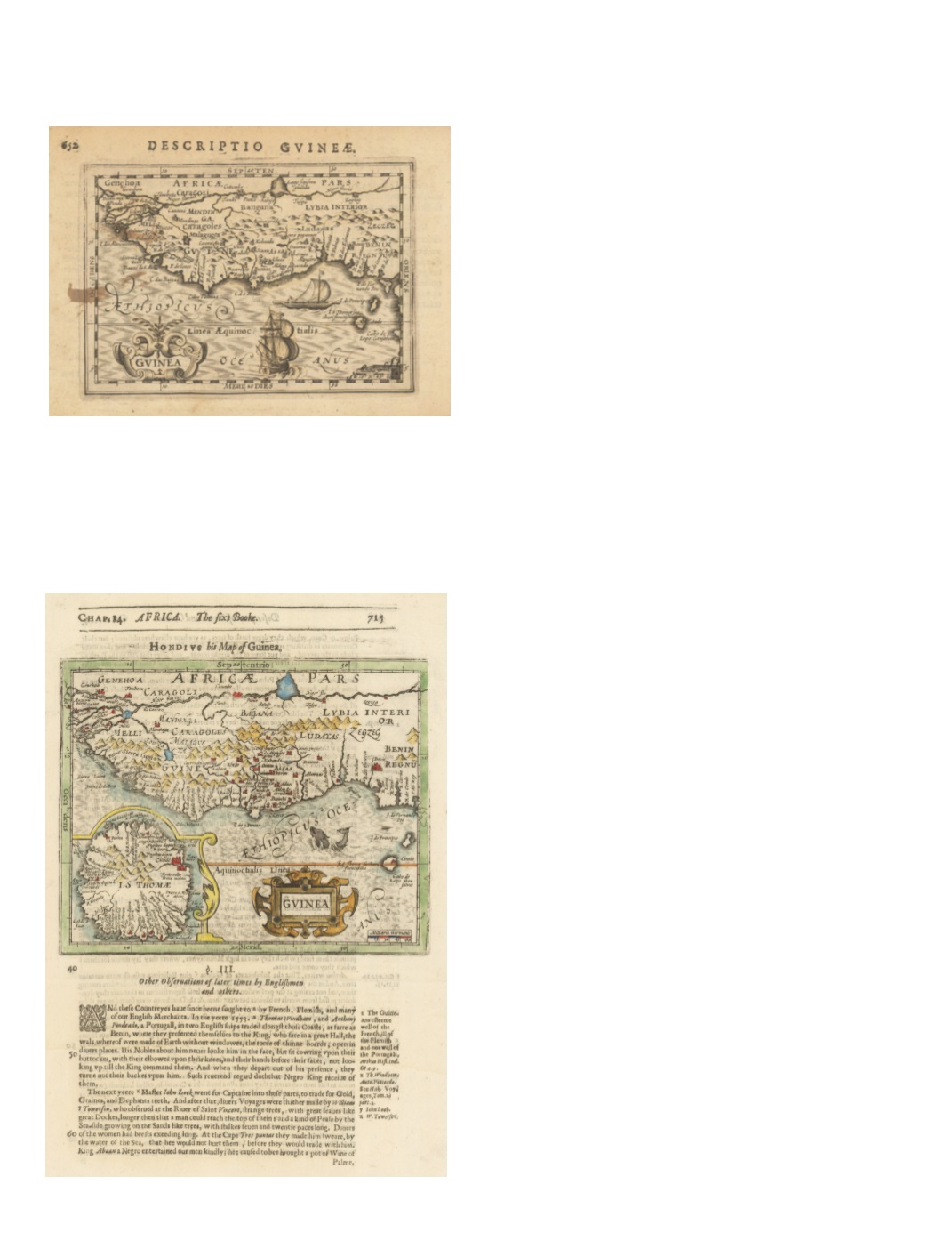
30) Guinea (under heading: Descriptio Gvineæ.) By: Petrus Kerius [Pieter van der Keere][For atlas of Petrus Bertius (Pieter de Bert) Date: 1618 (Published) Amsterdam Dimensions: 3.5 x 5.1 inches (9 cm x 13 cm) This intriguing small map is a highly decorative calligraphied page from a Latin edition of a miniature atlas, probably Tabularum Geographicarum, published in 1618. Depicts West Africa from Senegal to the Bight of Biafra. Lovely title cartouche surrounds the word “Guinea.” On the reverse, page 651, is a section of text in Latin headed by Descriptio Regni Tvnetani (Description of the Kingdom of Tunisia). Condition: Very good condition with a small faded ink stain on left margin and in Sierra Leone. $250 31) Hondius his Map of Guinea. By: Jodocus Hondius (Joost de Hondt) Printed by William Stansby for Henrie Fetherstone; In Purchas His Pilgrimes in Five Bookes, part 3, p. 715 Date: 1625 (Published) London Dimensions: 5.7 x 7.08 inches (14.5 cm x 18 cm) This lovely Hondius map of Guinea is from a book page headed “Chap. 14. Africa. The sixt Booke. 715,” and was originally from the Atlas Minor by Gerard Mercator and Johannes Janssonius of 1607. It displays the southern coast of West Africa from the area of Senegal to Nigeria at the Bight of Biafra. An inset shows an enlarged detail of the island of “I.S. Thomae” (St. Thomas). A marvelous sea creature embellishes the “Aethiopicus Oce.” The text, in English, describes European traders in the region, the reverence shown by locals to the King of Benin, and the goods obtained (“Gold, Graines, and Elephants teeth”). The reverse, page 716, is a text headed “Description of Benin and Guinea,” elaborating on the people and remarkable customs of the area. Condition: Good condition. $350