


 44 / 52

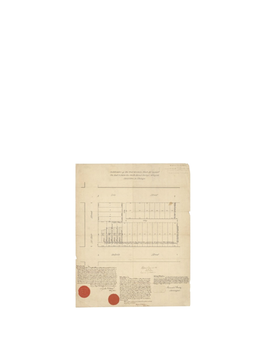
Subdivision of the West 394 Feet of Block 32 (except the East 14 Feet of the North 80 Feet
thereof) Kinzies Addition to Chicago
By:
Samuel S. Greeley
Date:
May 10, 1881
Dimensions:
23 x 18 inches (58.4 x 45.7 cm)
Signatures:
Samuel D. Greeley (City Surveyor), Leighton Williams (Notary, New York),
Eugene Fishburn (Notary, Cook County), H. J. Jones (Examiner of Subdivisions)
This map shows the west 394 feet of Block 32 in Kinzie’s Addition, subdivided into 27 lots with
a public and private alley. A dashed line notes the designated building line 19 feet away from
Ontario Street. As noted in the script, Marianna A. Ogden, William O. Wheeler and Andrew H.
Green are the Executors and Trustees of the land under the Last Will and Testament of the
deceased William B. Ogden. The map was notarized with two red seals in both Chicago and
New York.
Condition:
Contemporary folding with some splits along the edges and a stain within the image.
Ink stamp and script on verso is visible on the recto.