


 49 / 52

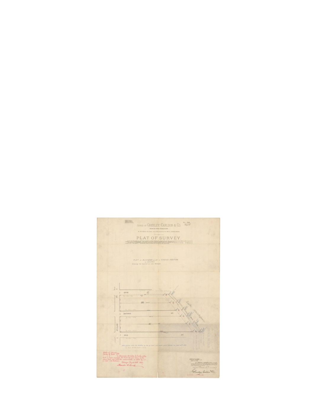
Plat of Blocks 31 and 32 in Kinzie’s addition to Chicago
Showing the Location of Lake Michigan
By:
Greeley Carlson & Co. Surveyors
Date:
March 15, 1887
Dimensions:
22 x 17 inches (55.9 x 43.2 cm)
Signatures:
Alexander W. Cooke (Surveyor)
This survey is unlike any of the previous surveys in that it does not distinguish any proprietors.
Instead it was made for the sole purpose of mapping the distance from the east side of St. Clair
to the edge of each lot, the top of a stone bank, and the water’s edge of Lake Michigan. While
numerous measurements were conducted and noted in 1887 (black, blue, and red ink), additional
measurements of a greater distance from 1882 are also noted in pencil. Common knowledge
tells us that the City of Chicago was consistently expanded eastward into Lake Michigan,
however this survey suggests otherwise. One can assume by the greater lot length in 1882 and
the attention given to a stone wall in 1887, that the lots were indeed shortened to make room for
a levee intended to protect the lots from Lake Michigan storm surges, flooding, and water
encroachment issues.
Condition:
Working manuscript map on thin watermark paper with some separations along
contemporary folds. Record of map on verso is visible on the recto.