


 14 / 52

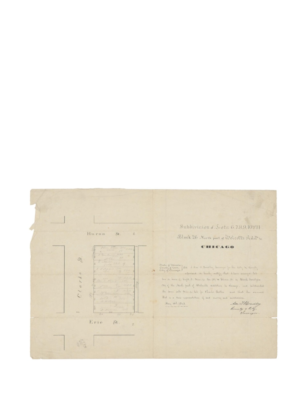
Subdivision of Lots 6,7,8,9,10 & 11 Block 26 North part of Wolcott’s addition to Chicago
By:
Asa F. Bradley
Date:
May 13, 1848
Dimensions:
14 x 16.5 inches (35.5 x 41.9 cm)
Signatures:
Asa F. Bradley (County & City Surveyor)
This map shows the West side of block 26, which was bordered by the streets of Clark, Huron,
and Erie as well as one alley running North and South. The lots shown (3 – 11) are all 110 ft.
deep and range between 20 and 29.4 feet wide. Written in pencil within each lot, are the names
or their respective owner as well as the price paid for them, which ranged from $280 to $450.
This is the earliest map to note Asa Bradley as both the County and City surveyor.
Condition:
Intentionally folded with a separation along the vertical centerfold that has been
repaired on verso. Pencil markings believed to be contemporaneous with the piece. Light foxing
and damage to the edges apparent. Red manuscript visible on verso.