


 18 / 52

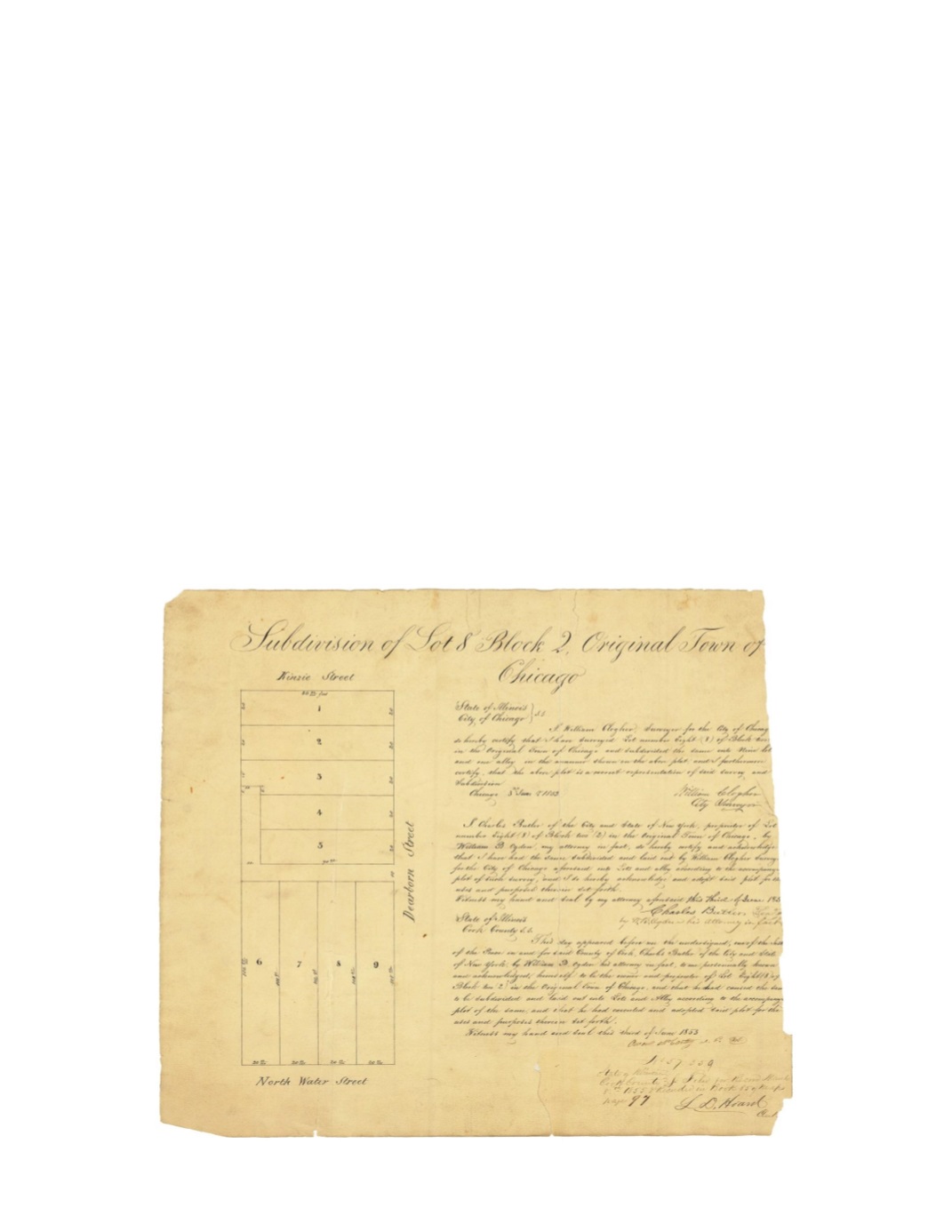
Subdivision of Lot 8 Block 2 Original City of Chicago
By:
William Clogher Surveyor for the City of Chicago
Date:
June 3, 1853
Dimensions:
15 x 15 inches (38.1 x 38.1 cm)
Signatures:
William Clogher (City Surveyor), William B, Ogden (Attorney for Charles Butler),
L.D. Hoard (Recorder)
This map shows one of the first blocks north of the Main Branch of the Chicago River. Lot 8 of
Block 2 is bordered by the streets of Kinzie, Dearborn, and North Water, has since been broken
up and shortened to only a few blocks east and west of Michigan Avenue. Like much of the land
in Chicago’s early existence, these lots were owned by Charles Butler and signed for by his
brother-in-law William B Ogden.
Condition:
Complete loss of the far right edge with a vertical break through the center that
divides the map into two pieces. Another vertical break runs through much of the mapped
subdivision. Map was made on thick paper that has become brittle, thus several chips and
missing pieces are apparent.