


 20 / 52

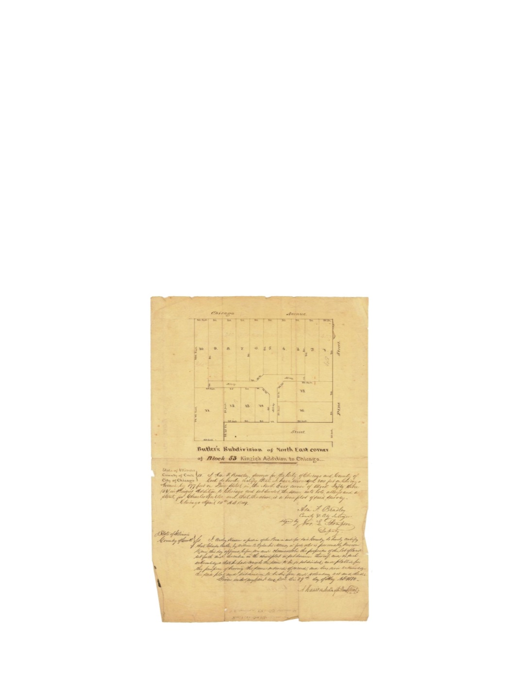
Butler’s Subdivision of North East Corner of Block 53 Kinzie’s addition to Chicago
By:
Asa F. Bradley
Date:
April 10, 1849
Dimensions:
15.5 x 10 inches (39.4 x 25.4 cm)
Signatures:
Asa F. Bradley (City & County Surveyor) Joseph E. Thompson (Deputy), Archy
Kasson (Justice of the Peace)
This map shows the northeast portion of Block 53 of Kinzie’s addition. The Subdivision was
divided into sixteen separate lots with alley access to all but one of them. The subdivision was
bordered by an unnamed street to the south, Chicago Avenue to the north and Pine Street, which
would later become St. Clair to the east. As noted in the title and script below, the subdivision
was owned by Charles Butler of New York.
Condition:
Intentionally folded with
light foxing with marginal folds and minor separations.
Manuscript on verso is visible on recto.