


 15 / 52

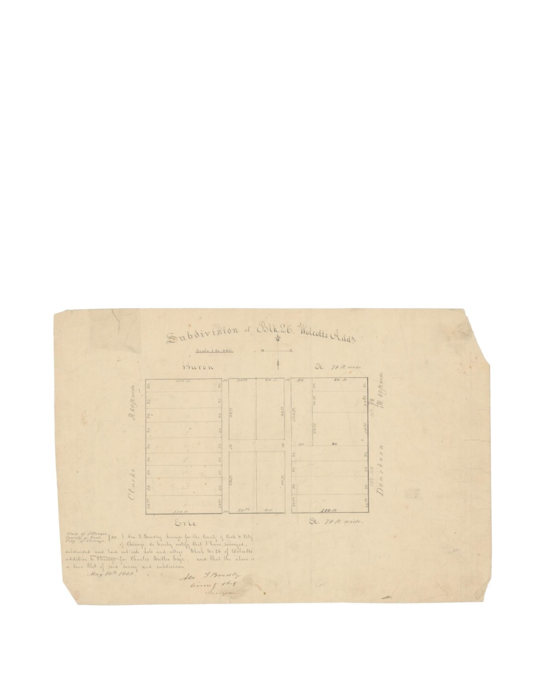
Subdivision of Block 26 Wolcott’s addition to Chicago
By:
Asa F. Bradley City and County Surveyor
Date:
May 10, 1849
Dimensions:
12 x 15.5 inches (30.5 x 39.4 cm)
Signatures:
Asa F. Bradley (County & City Surveyor)
This map shows all of Block 26 as surveyed and laid out into lots and alleys for Charles Butler
Esq. The block is bordered by the streets of Clark, Huron, Dearborn, and Erie, with two alleys
running North and South and another alley connecting them. The alleys in this map still exist
today except for the North half of the West alley. A compass rose is given below the title as well
as a distance scale showing 1” to 480’.
Condition:
Light soiling and foxing with paper loss at the corners. A small tear visible at top
left has been repaired long ago on the verso. Manuscript in ink and pencil on verso.