


 19 / 52

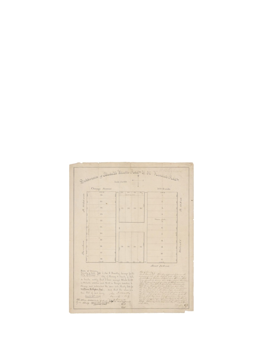
Subdivision of Blocks 33 Wolcott’s Addition & 50 Kinzie’s Addition
By:
Asa F. Bradley
Date:
March 30, 1849
Dimensions:
16.75 x 14 inches (42.5 x 35.5 cm)
Signatures:
Asa Bradley (County & City Surveyor), Thomas Toole (Proprietor), H. Duffy
(Justice of the Peace)
This map shows one city block owned by two separate proprietors, William B. Ogden and
Thomas Toole. The block has been divided into thirty separate lots and includes an “H” alley
design. The streets that border the lots are Dearborn, Wolcott (State St.), Chicago Avenue, and
Street 74
th
Ward (Superior St.) Some of the divided lots feature dashed building lines that create
sidewalks of 10 and 15 feet wide. Today much of this area has been converted into a parking lot,
but the west alley is still in use.
Condition:
Intentional contemporary folding with minor separations along the margins. Small
portion of the lower right corner is missing. Contemporary manuscript on the verso.