


 25 / 52

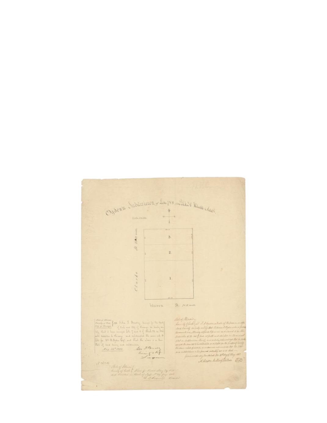
Ogden’s Subdivision of Lots 7 & 8 in Block 31 Wolcott’s Addtn.
By:
Asa F. Bradley
Date:
May 14, 1849
Dimensions:
16.5 x 13.5 inches (41.9 x 34.3)
Signatures:
Asa Bradley (City & County Surveyor), Archy Kasson (Justice of the Peace), L.D.
Hoard (Recorder)
This map shows a small subdivision consisting of three lots from what were originally lots 7&8
of Wolcott’s Addition. The script to the right notes that the lots belonged to William B. Ogden,
who appeared before Archy Kasson on May 27, 1850. The lots were located at the corner of
Clark St. and Huron St. Below the title is a scale of 1” to 240’ and a compass rose. On May 29,
1850, L.D. Hoard recorded this survey in Book of Maps No. 29 as page 108.
Condition:
Some minor edge tears and light foxing with one hole along Clark Street.