


 22 / 52

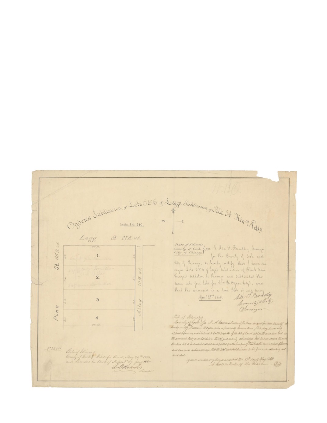
Ogden’s Subdivision of Lots 5 & 6 of Legg’s Subdivision of Block 54 of Kinzie’s Addtn.
By:
Asa F. Bradley
Date:
April 23, 1849
Dimensions:
13.5 x 16.5 inches (34.3 x 41.9 cm)
Signatures:
Asa F. Bradley (City & County Surveyor), Archy Kasson (Justice of the Peace)
L.D. Hoard (Recorder)
This map shows the northwest corner of Block 54 divided into four lots for its proprietor
William B. Ogden. The lots are bordered by an alley on the east, Legg Street on the north, and
Pine Street on the west. There is a scale of 1 inch to 240 feet and a compass rose below the map
title.
Condition
: Paper loss at top right with numerous small tears extending from the margins.