


 24 / 52

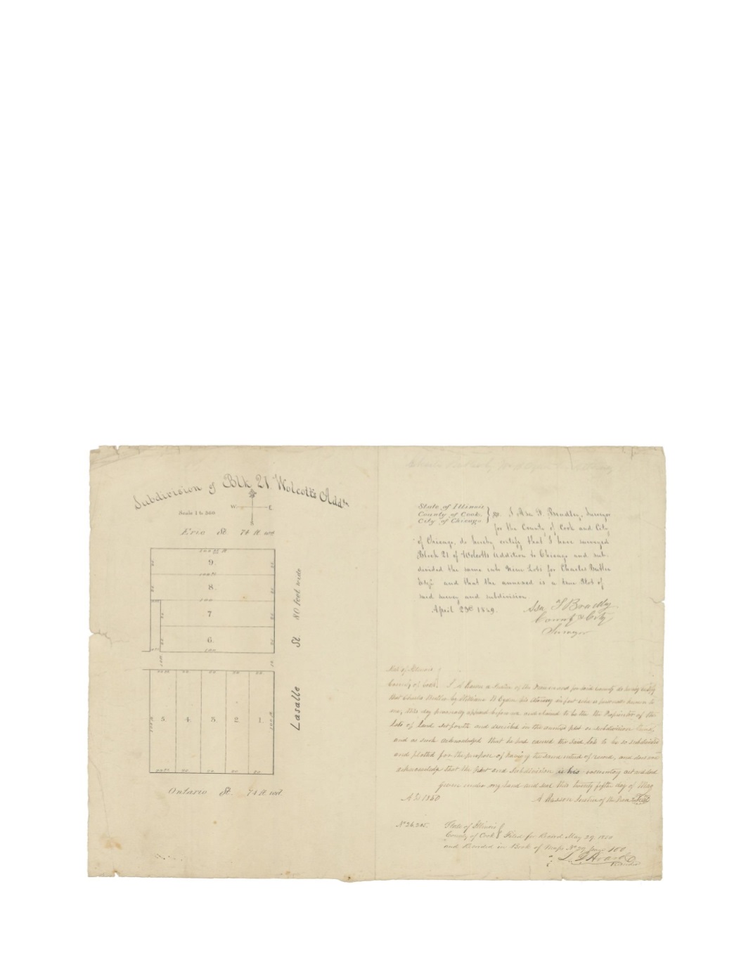
Subdivision of Block 21 Wolcott’s Addtn.
By:
Asa F. Bradley
Date:
April 23, 1849
Dimensions:
14 x 16.75 inches (35.5 x 42.5 cm)
Signatures:
Asa Bradley (City & County Surveyor), Archy Kasson (Justice of the Peace), L.D.
Hoard (Recorder)
This map is a land survey of the eastern half of Block 21 in Wolcott’s Addition, subdivided into
nine separate lots. The subdivision is bordered by the streets of Erie to the north, LaSalle on the
east and Ontario to the south. The map features a compass rose and a scale of 1” to 360’ just
below the title. The script notes William B. Ogden appearing before the Justice of the Peace on
May 25, 1850 on behalf of Charles Butler, the proprietor of the subdivision. On May 29, 1850,
L.D. Hoard recorded this survey in Book of Maps No. 29 as page 100.
Condition:
Several minor edge tears, none of which distract from the map or script. Some light
foxing is apparent.