


 10 / 60

10
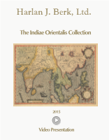
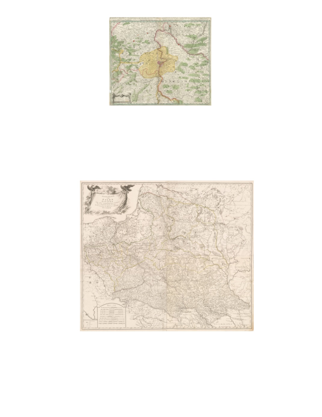
14) Die Gegend um Prag oder der alte Prager Kreys nebst den angranzenden Landschafften des Rakonizer, Boleslawer u. Kaurzimmer Cr. Aus dem Müllerischen un ans Tagslicht gestellt von Hom.Erb. C.PS.C.M.A. 1742 By: Homann heirs Date: 1742 (dated) Nürnberg Dimensions: 19.3 x 23inches (49 x 58.5 cm) This map offers a strikingly detailed view of the surroundings of the city of Prague and its suburbs, with the Vltava River flowing up the center and joining with the Elbe River at Melnik in the north. Slaný (Schlan) and Beroun (Beraun) lie to the west, Č eský Brod (Böhmisch Brod) to the east, and Slapy (Slap) to the south. Condition: A sharp print with bright original color. A small piece is missing from the lower left margin (1 cm x 2 cm), outside the inner margin line. Trimmed very close along the top, with some loss to the title, above the margin. $450 15) Generalkarte von Polen Litauen und den angrænzenden Lændern Nach Zannoni, Follin, Uz, Pfau &c., &c. By F. A. Schræmbl Date: 1788 (published) Vienna Dimensions: 33 x 38 inches (84 x 97 cm) This map of Poland and Lithuania in 1788 depicts a dense network of roads and towns. It also includes much of present-day southern Latvia, Belarus, and western Ukraine (including Kiev [“Kiov”]; Kiyv). It additionally covers as far south as Tokai (Tokay, Hungary), and Bukovina (in northern Romania); and as far west as Breslau (Wroclaw) in Silesia, and eastern Pomerania. Condition: Very good condition. Single sheet made up of four sheets combined. One lower center fold reinforced on verso and one small separation at a fold intersection in the top center. The bottom right sheet shows light discoloration. Minor separations and tears on both side margins with only one entering the image about 1 cm. $2,250