


 6 / 60

6
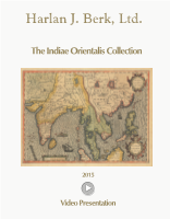
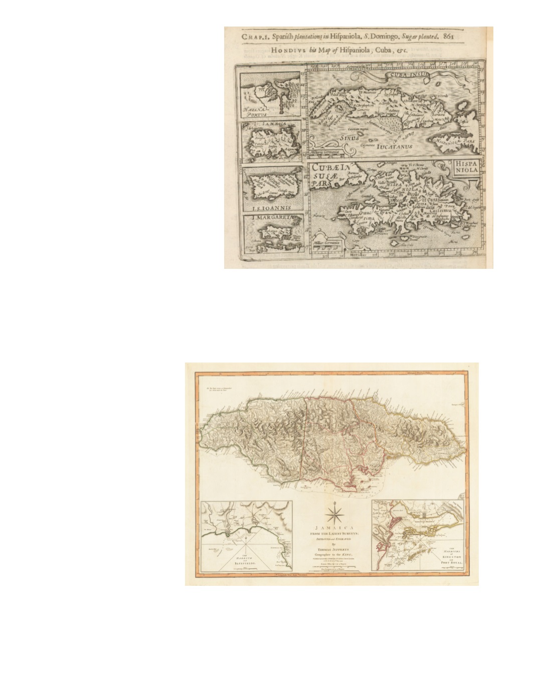
6) Hondius his Map of Hispaniola, Cuba, &c. By: Jodocus Hondius / Henrie Fetherstone Date: 1625 (published) London Dimensions: 5.7 x 7.3 inches (14.5 x 18.5 cm) This was originally from the Atlas Minor by Gerard Mercator and Johannes Janssonius, 1628. It displays six separately framed maps, Cuba at the top with Hispaniola below, and stacked insets at the left, of Havana Port, Jamaica, St. John, and Margarita (island off the coast of Venezuela, northwest of Trinidad). The text, in English, describes the city of Santo Domingo and its history under the Spanish and the introduction of sugar cane. The reverse is text headed “Spanish plantations, Ports, numbers in Hispaniola.” Condition: Right edge of page appears to have been trimmed in binding, slightly cutting into the map’s lower right margin, so a strip of paper has been added. $250 7) Jamaica from the Latest Surveys By: Thomas Jefferys Date: 1794 (dated) London Dimensions: 18.1 x 24.2 inches (46 x 61.5 cm) Impressive depiction of mountain relief, with much detail of settlements and roads. Two insets offer details of the Harbour of Bluefields, on the island’s southwest coast, and the Harbours of Kingston and Port Royal, with detailed depth soundings, shoals, reefs, and sandbars. An interesting notation on the map reads “The Negro-towns are Distinguished by a Stroke under the Name.” Condition: Excellent impression on clean watermarked paper with original coloring and full margins. $550