


 8 / 60

8
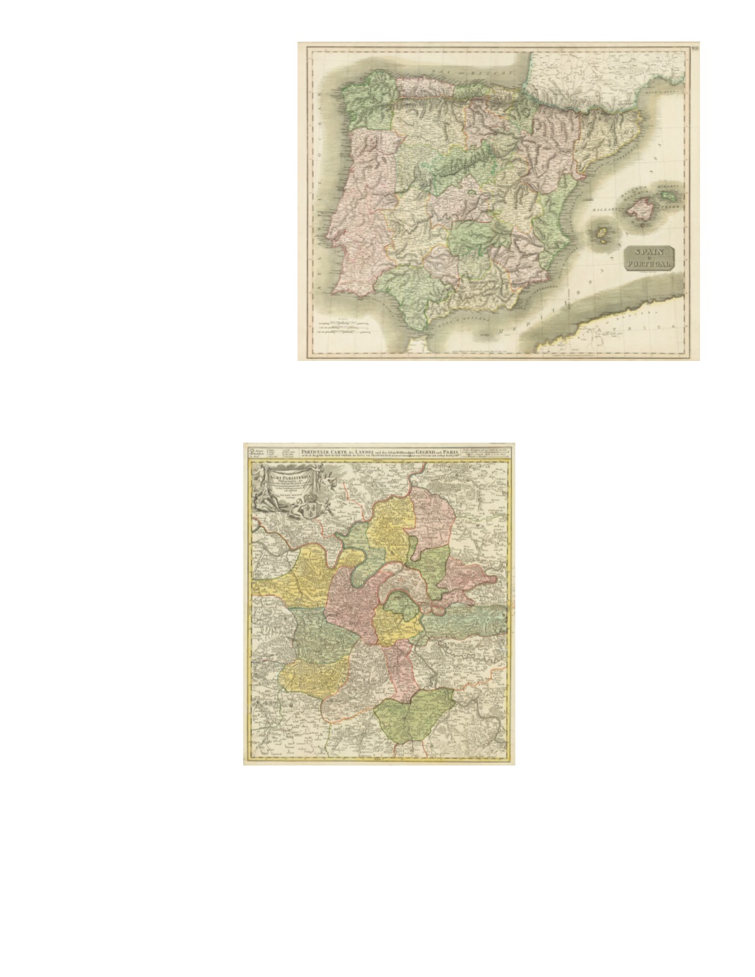
10) Spain & Portugal By: John Thompson Date: 1815 (published 1817) Edinburgh Dimensions: 20.8 x 25.6 inches (53 x 65 cm) Detailed rendering of the countries, with excellent topographical detail showing the mountains presented with hachures. Rivers and towns are extensively shown as well as the network of major roads. The map includes the Balearic Islands of Ibiza, Mallorca, and Menorca. Condition: Excellent condition showing a strong impression, original coloring, and ample margins. $450 11) Agri Parisiensis. Tabula particularis, qua maxima Pars Insulæ Franciæ, seu Regiæ celeberrimæque Parisiorum Urbic vicinia Regio in suas Castellanias accurate divisa exhibetur a Ioh. Bapt. Homanno By: Johann Baptist Homann Date: 1707 (published) Nürnberg Dimensions: 21.5 x 18.7 inches (54.5 x 47.5 cm) This map of the environs of Paris extend from Mantes in the northwest, past Pontoise to Chantilly and Senlis in the northeast; down to Melun and Fontainebleau in the southeast; and over to Epernon and Gallardon in the southwest. Included is Versailles with the palace grounds larger in extent than the built-up area of Paris indicated. Condition: Some annotations are apparent within the map and along the right margin (likely from the 18th or 19th century). A soft rolled fold runs the width of the map. $450