


 7 / 60

7
Europe
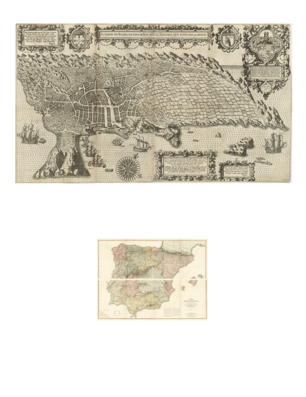
8) A Cidade De Angra.Na Ilha De Iesu Xpoda Tercera Que Esta Em 39 Graos. By: Jan Huygen van Linschoten Date: 1596 (published) Amsterdam Dimensions: 18.7 x 32.7 inches (47.5 x 83 cm) This is an extraordinarily executed bird’s-eye view of the town of Angra on the Island of Terceira in the Azores, with its harbor, fortress, and surrounding fields and mountains. Embellished with a superb compass rose, renderings of European sailing ships, and coats of arms of Portugal, the Azores, and Portuguese administrator, Christophoro Mouro. Condition: Archivally reinforced on the back in several areas where vertical and horizontal folds meet. Two minor spots of foxing. Map has been trimmed on all sides with little to no loss to the margins. $2,750 9) A New Map of Spain and Portugal, exhibiting the Chains of Mountains With their Passes the principal & cross roads, with other details requisite for the Intelligence of Military Operations compiled by Jasper Nantiat By: William Faden Date: 1810 (dated) London Dimensions: 61.2 x 44 inches(155.5 x 112 cm) This large-scale, four sheet map of the Iberian Peninsula was published during the Britain’s Peninsular War under Wellington against Napoleon. Other versions were dissected and backed with linen to be used as a traveling folding map. The passes referred to in the title are those between Portugal and Spain. Condition: Excellent condition, with a somewhat narrow lower right margin and a small piece missing from lower right corner. No loss to image. $850