


 12 / 60

12
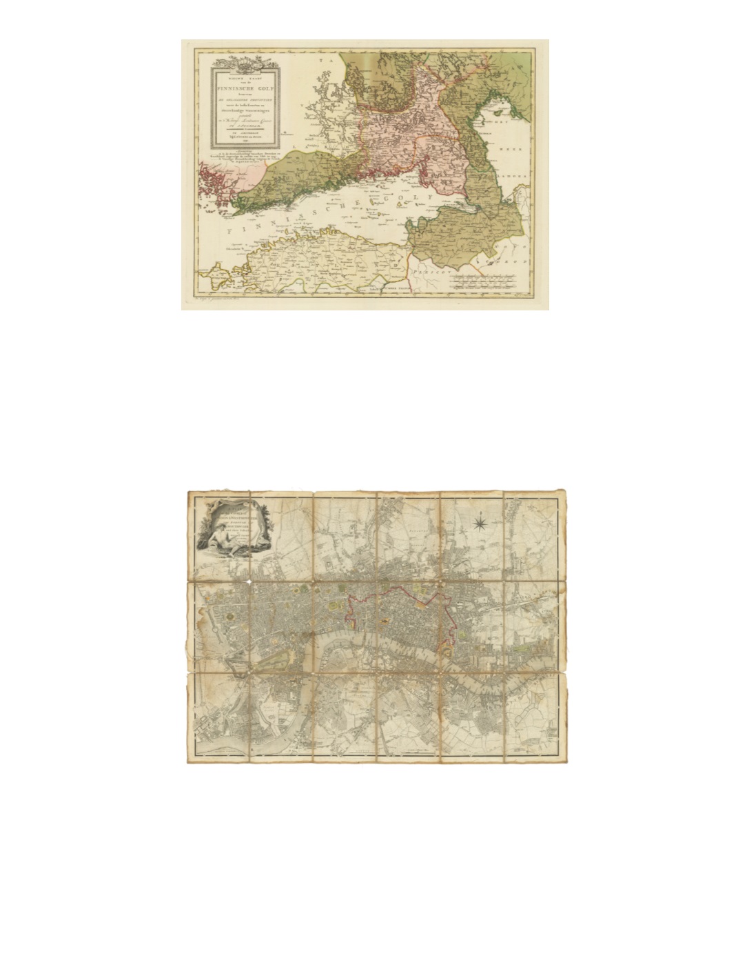
18) Nieuwe Kaart van de Finnissche Golf benevens de omliggende Provintien naar de beste Kaarten en Sterrekundige waanemingen, Geteckend in’t Koningl: Landmeeters Comtoir te Stockholm By: I. Covens en Zoon Date: 1791 (Published) Amsterdam Dimensions: 14.6 x 20 inches (37 cm x 50.5 cm) This fantastic map displays the Gulf of Finland, from the southern coast of Finland as far west as Åbo (Turku), eastward to St. Petersburg, Russia, and then westward across the north coast of Estonia as far as the island of Hiiumaa (Dagö). Also included is the western side of Lake Ladoga. The map shows many inland towns and roadways and displays the region after the first partition but before the second of 1795. Condition: Excellent condition showing a strong impression, original color and wide margins all around. Some discoloration is noticeable along the top centerfold and slightly to the left.$1,750
Europe: City Plans
19) A Plan of the Cities of London & Westminster The Borough of Southwark and their Suburbs By: William Faden Date: 1785 (Published) London Dimensions: 20 x 28 inches (50 cm x 71 cm) This fantastic traveler’s folding map is dissected into 16 segments and mounted on salmon-colored linen. Label on the back: “A Paris Chez Perrier / A l’Hotel de Soubise,” with handwritten inscription, “Plan de Londres,” and in a different color ink “on 1785.” This intriguing detailed street map displays London in the late 18th century. City of London is outlined in red, some squares colored green, certain streets in light orange. Attractive pictorial cartouche of the River Thames personified. Condition: Well-utilized traveler’s map from the 18 th c with some water stains and separations along the linen folds. $1,500