


 4 / 60

4
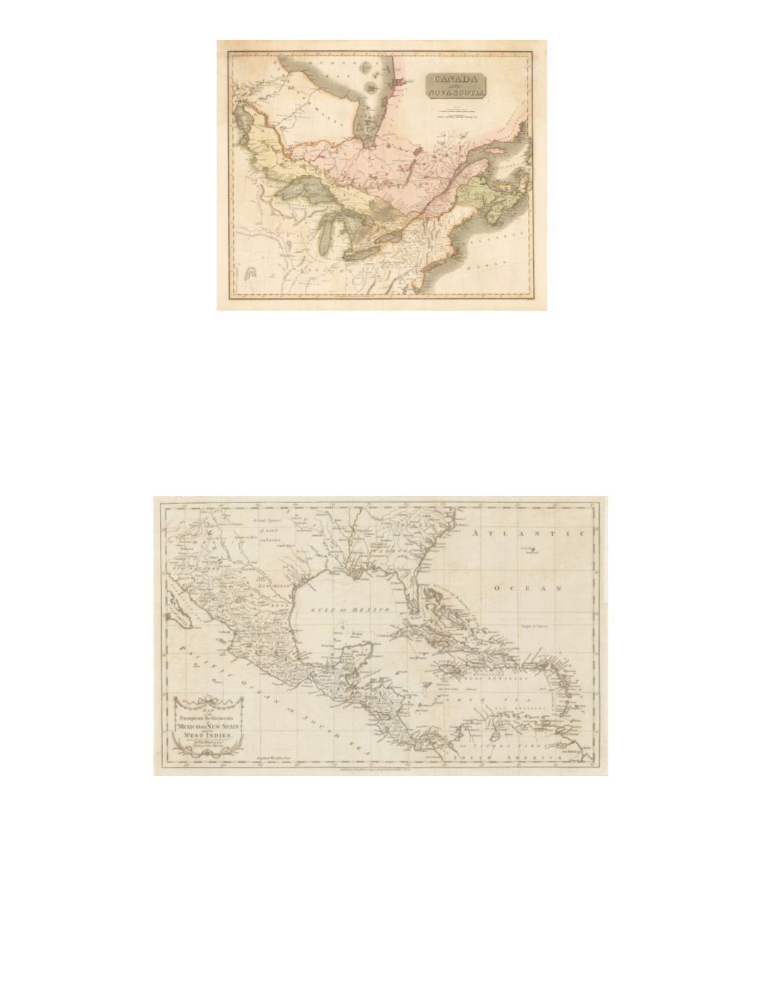
2) Canada and Nova Scotia By: John Thompson Date: 1817 (published) Edinburgh Dimensions: 18.9 x 23.2 inches (48 x 59 cm) This finely detailed map Includes Lake Winnipeg, southern Hudson Bay, the Great Lakes, Gulf of St. Lawrence, and the Atlantic Ocean coast as far south as Delaware Bay. Part of present-day western Ontario is labeled New South Wales. New Brunswick includes much of present-day northern Maine. Toronto is labeled York. Large regions are labeled with names of Indian tribes, including in Lower Canada north of the St. Lawrence River. North of Lake Huron is called Chippeway Hunting Country. The Western Territory includes many Indian tribal names. Condition: Some light damp staining in upper left and upper right corners with a minor lower centerfold separation that does not enter the image. Map presents lovely original coloring. $500 3) Map of the European Settlements in Mexico or New Spain and the West Indies. By: Thomas Kitchin Date: 1783 (published) London Dimensions: 12 x 19.7 inches (30.5 x 50.5 cm) The focus of this map is Mexico, Central America, and the Caribbean, though it extends into North America as far as Santa Fe and North Carolina as well as northern South America. Remarkably, the region north of present-day Texas is labeled “Great Space of Land unknown.” Southern Florida appears as a cluster of multiple islands. Condition: Issued folded now flattened, and backed with a thin sheet of acid-free archival paper. $300